高加索和中亞向量圖。帶海、湖、河和地理邊界的復古插圖 插畫檔
Caucasus and Central Asia Vector Map. Vintage Illustration with Sea, Lakes, Rivers and Geographical Borders
Map was found: http://legacy.lib.utexas.edu/maps/commonwealth/caucasus_cntrl_asia_pol_2003.jpg
Created in Adobe Illustrator with splines 15-07-2020

在 Photos.com 上購買這張圖片,更提供不同的相框選項。
購買授權
所有免版稅授權包含全球使用權限、全面的法律保障,定價簡單並享有計量折扣。
HK$2,250.00
HKD
Getty Images, 照片檔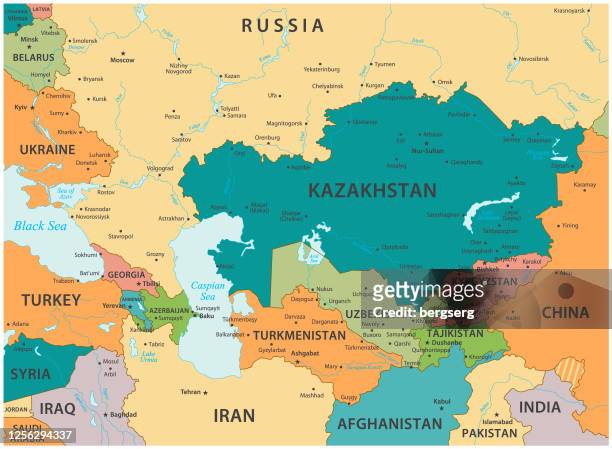 從 Getty Images 下載優越而真實的高加索和中亞向量圖。帶海、湖、河和地理邊界的復古插圖插畫檔。在我們廣泛多元的視覺內容目錄中,探索類似的高解像度插畫檔。Product #:1256294337
從 Getty Images 下載優越而真實的高加索和中亞向量圖。帶海、湖、河和地理邊界的復古插圖插畫檔。在我們廣泛多元的視覺內容目錄中,探索類似的高解像度插畫檔。Product #:1256294337HK$2,250HK$400
Getty Images
In stock